Identify areas that are worthwhile protecting
By referencing the inundation map created by Kummu and Sarkkula (2008), it is noticeable that certain sections of the flooded forest in Tonle Sap Lake remain unaffected by the inundation resulting from elevated water levels during the dry season. Notably, some of these non-impacted flooded forest areas are situated within the Ramsar Site and Biosphere Reserve, adding weight to their consideration due to their established status as conservation areas.
The ideal area for compensating the loss of flooded forest is characterized by a low risk of permanent inundation caused by the dry-seasonal flow pulse. Additionally, it should be a vacant space with limited human activity, or activities that can be relocated. Moreover, it is crucial that the chosen area experiences minimal hydrological disruption, ensuring proper sediment transport, nutrient flow, and functional river connectivity to support a successful revegetation process.
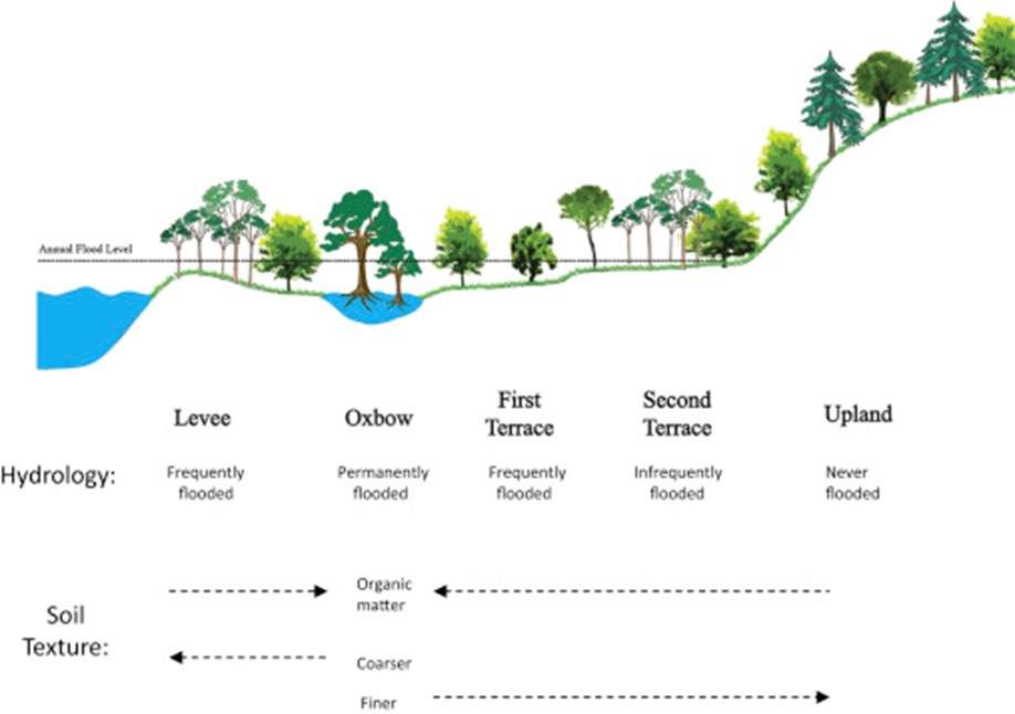
Cross-section of a forested floodplain wetland showing the major landforms and height of the annual flood pulse. Different assemblages of trees occupy the different habitats that vary with depth and duration of flooding (source: Craft, 2016)