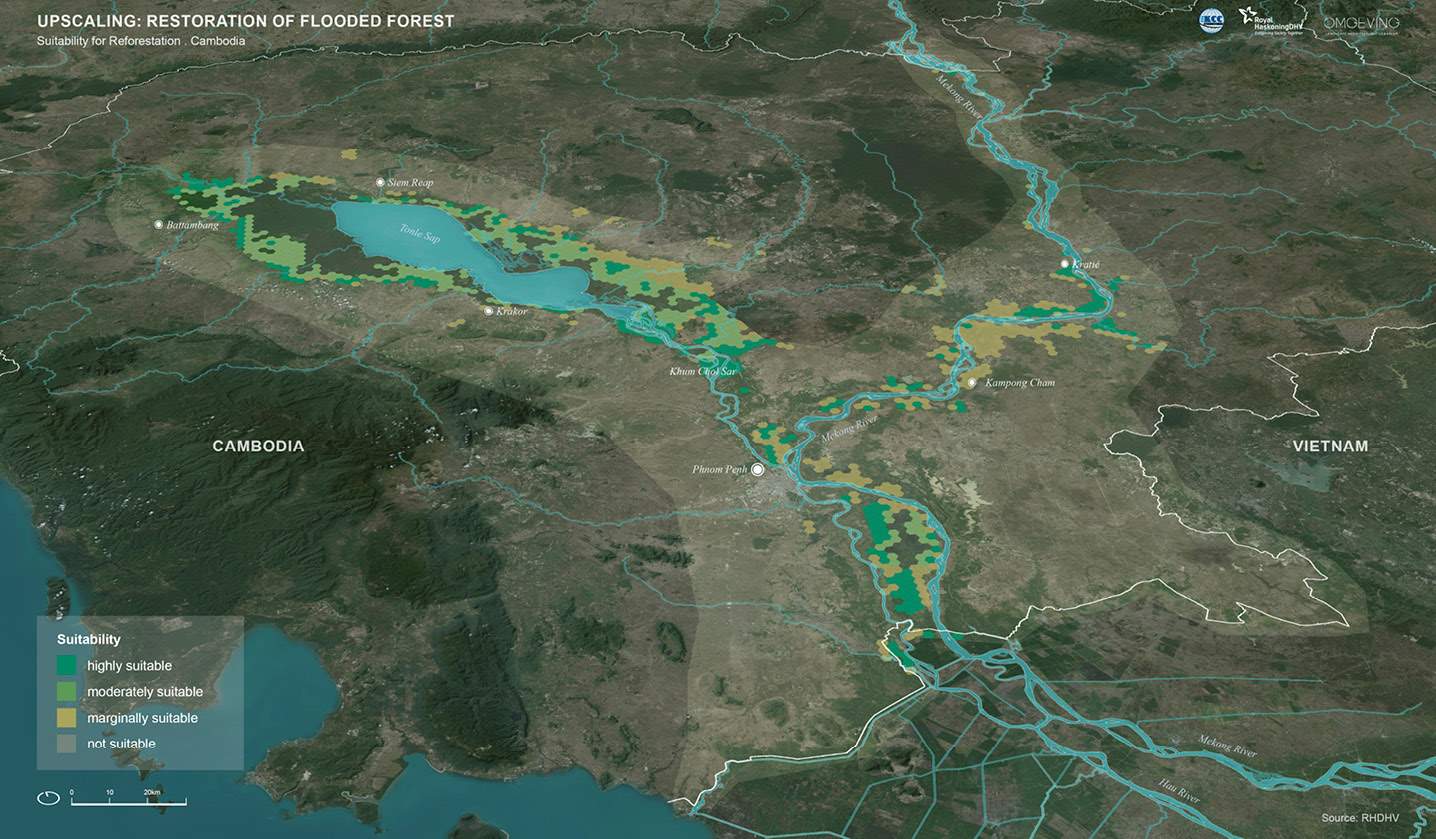
Upscaling potential maps
The map below shows the suitability of restoration of the flooded forest in Cambodia. Areas in dark green are highly suitable for reforestation. In general, the following areas have potential for reforestation projects:
-
Flooded forest along the fringes of the Tonle Sap lake. These areas are encroached due to anthropogenic pressures – mostly by human settlement and agricultural expansion towards the lake.
-
Flooded forest along the Tonle Sap and Mekong River. These areas also have a high technical potential for upscaling reforestation projects. The shift of communities from fishing to agriculture (due to decreasing catch rates), particularly rice and other crops, has led to the conversion of flooded forest into new agricultural land. Nevertheless, the biophysical characteristics of these areas remain highly suitable for flooded forest to thrive.